AeroScan based on Riegl Lidar technology
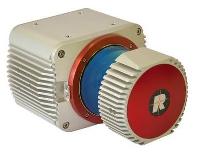 Airborne laser scanning is a rapid, highly accurate and efficient method of capturing 3D data of large areas, such as agricultural or forestry sites, urban areas, industrial plants, etc.
We integrate RIEGL airborne laser scanners to make use of the latest cuttingedge laser and signal processing technology. They are exceptionally compact, lightweight and cost effective and are designed to meet the most challenging requirements in airborne surveying.
| ALS Scanner | Airborne Laser Scanners | |||||
| RIEGL LMS-Q680i | NEW RIEGL VQ-780i | RIEGL VUX-1LR | RIEGL VQ-580 | RIEGL VQ-480i | RIEGL VQ-820-G | |
| Key words | long range, digital full waveform processing | High altitude wide area mapping | Especially designed to measure on snow and ice | compact and lightweight device | topo-hydrographic scanner, high accuracy | |
| Short text description | Long range waveform digitizing airborne laser scanner for wide area, corridor, and city mapping | Waveform Processing Airborne Laser Scanner for Wide Area Mapping and High Productivity | Long Range Laser Scanner for airborne laser scanning | Long range, online waveform processing airborne laser scanner for measurements on snow and ice | Medium range and high speed online waveform processing airborne laser scanner for corridor and city mapping | Topo-Hydrographic Airborne Laser Scanner with Online Waveform Processing |
| Eye safety class | Laser Class 3R | Laser Class 3B | Laser Class 1 | Laser Class 3B | Laser Class 1 | Laser Class 3B |
| Max range target reflectivity 60% | up to 3000 m | up to 6800 m | 1,350 m | up to 2350 m | up to 2100 m | 2500 m |
| Max range target reflectivity 20% | up to 2000 m | up to 4500 m | 820 m | up to 1500 m | up to 1300 m | 1500 m |
| Min range for natural targets | 30 m | 100 m | 5 m | 10 m | 10 m | 10 m |
| Accuracy | 20 mm | 20 mm | 15 mm | 25 mm | 20 mm | 25 mm |
| Repeatability single shot | 20 mm | 20 mm | 10 mm | 25 mm | 20 mm | 25 mm |
| Effective measurement rate | up to 266000 meas./sec | up to 666000 meas./sec | 750,000 meas./sec | up to 190000 meas./sec | up to 275000 meas./sec | up to 200000 meas./sec (@520 kHz PRR & 42° FOV) |
| Beam divergence | 0.5 mrad | 0.18 mrad / 0.25 mrad | 0.5 mrad | 0.2 mrad | 0.3 mrad | 1.0 mrad |
| Number of targets per pulse | unlimited | unlimited | practically unlimited | practically unlimited | practically unlimited | unlimited (digitized waveform processing) |
| Vertical line scan - max scan angle range | up to 60° | up to 60° | 60° | 60° | 42°, max. 60° | |
| Vertical line scan - min angle step width | 0.002° | 0.006° | 0.003° | 0.002° | 0.01° | |
| Max. operating flight altitude AGL | 1600m / 5000ft | 1600m / 5000ft | 1200m / 3950ft | 1200m / 3900ft | ||
| Topography & Mining | - | - | ||||
| Corridor Mapping | - | - | ||||
| City Modeling | - | - | ||||
| Mapping of Lakesides & River Banks | - | - | ||||
| Agriculture & Forestry | - | |||||
| Target Classification | - | - | ||||
| Glacier & Snowfield Mapping | - | - | - | |||
| Obstacle Detection for Unmanned Aerial Vehicles UAV | - | - | - | |||
| Power Lines | - | - | ||||
| Corridor Mapping: Power Line, Railway Track, and Pipeline Inspection | - | - | - | - | - | |
| Topography in Open-Cast Mining | - | - | - | - | - | |
| Terrain and Canyon Mapping | - | - | - | - | - | |
| Surveying of Urban Environments | - | - | - | - | - | |
| Archeology and Cultural Heritage Documentation | - | - | - | - | - | |
| Resource management | - | - | - | - | - | |
| Legend | |
| excellent for the selected application | |
| very good | |
| good | |
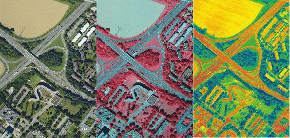
5-Band System (red edge)
"Red edge refers to the region of rapid change in reflectance of vegetation
in the NIR range of electromagnetic spectrum. Chlorophyll contained in vegetation absorbs most of the light in the visible part of the spectrum but becomes almost transparent at wavelengths greater than 700 nm. This way, vegetation cellular structure takes its major part in the reflectance because each cell acts like an elementary corner reflector. This effects in that rapid change that can be from 5% to 50% reflectance between 680 nm to 730 nm. (...) The phenomenon accounts for the brightness of foliage in infrared photography and is extensively utilized in the form of so-called vegetation indices (e.g. NDVI). It is used in remote sensing to monitor plant activity, and it has been suggested that it could be useful to detect light-harvesting organisms on distant planets." (Wikipedia)
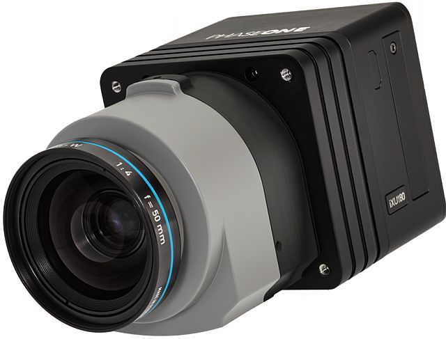
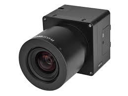
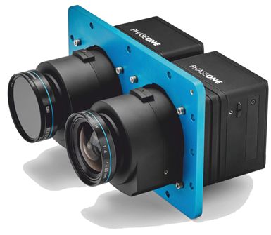
Based on the PhaseOne camera technology we provide a 5-band solution for capturing data sufficient for red-edge analysis. Using our AeroStab-M, we host 3 cameras stabilized and directly georeferenced as a turnkey solution. In combination with an adapted iX Cature software solution we also provide a workflow to generate RGBI, NDVI and CIR images for your data analysis.
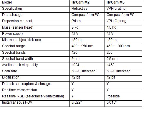
Hyperspectral sensors
Technical data

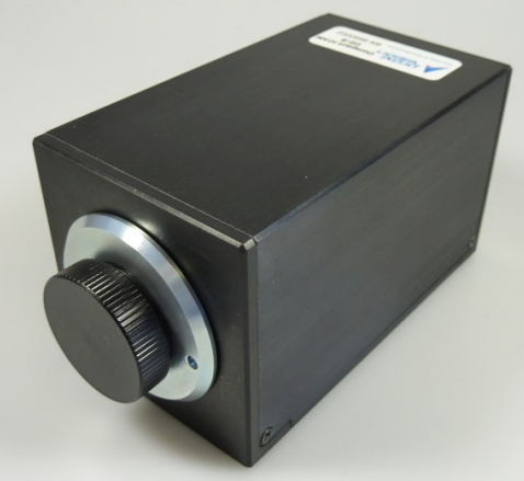
UV Systems (RGB + UV cams)
UV Corona effects on power lines are an important feature to detect failures in monitoring programs. We provide UV/RGB detector systems to capture data of both corona radiation and the corresponding visualized RGB image up to 30 fps and 1.4 MPIX resolution. We block the sunlight in order to generate pure UV radiation by using amplifier technology.
IMAGE INTENSIFIER: Active diameter 18 or 25 mm Input window Clear glass Photocathode Solar-blind, Bi-Alkali, S20, S25, for different spectral sensitivities in the range of 180..850 nm Phosphor screen P43, P46, P47 Blemish specification Standard camera blemish specification; Coupling method to CCD 25:11 or 18:11 fiber-optical taper.
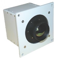
AeroTherm
AeroTherm is a thermal infrared single camera, available as cooled or uncooled sensor. It enables monitoring of objects that emit thermal radiation. The airborne thermography is useful for many applications such as :
- thermal insulation of objects and cities
- border and industrial plant security
- inspections of pipelines, high voltage power lines and isolators
- water quality monitoring
- management of forest fires and hot spots by improved visibility
- through smoke and darkness
- surveys of underground steam system
- change detection
- animal detection
- humidity monitoring
AeroTherm can be fully integrated with AeroTopoL FMS and the AeroStab family. The camera is managed by the AeroTherm Control software via Firewire. Real-time control of the actual data is supported. Other sensors can be used in combination with AeroTherm e.g. LiDAR with AeroScan or RGB imaging with AeroCam.
Oblique Thermal System (OTS)
The OTS Capture software enables the control of all synchronized sensor heads and can also be accessed via web beside the FMS. OTS capture is interfaced with AeroTopoL and that way your mission can be planned and executed as easily as with any single camera.


